New Research Quantifies Mississippi River Floodwaters Diverted Into Lake Pontchartrain
Research by Texas A&M Oceanography graduate student Robert Iles tracks diverted Mississippi floodwaters throughout Lake Pontchartrain with satellite imagery.
Sep 25, 2020
Multiple times a year, New Orleans and many surrounding cities risk flooding. The most infamous floods stem from hurricanes, but the more common cause is rains that raise the water levels of the Mississippi River, causing it to overflow its banks.
To combat this threat, a series of spillways were built to relieve that pressure by diverting massive amounts of freshwater out of the Mississippi River to adjacent bodies of water. While this protects human populations down-river, it can also majorly impact the bodies of water receiving the diverted Mississippi flow.
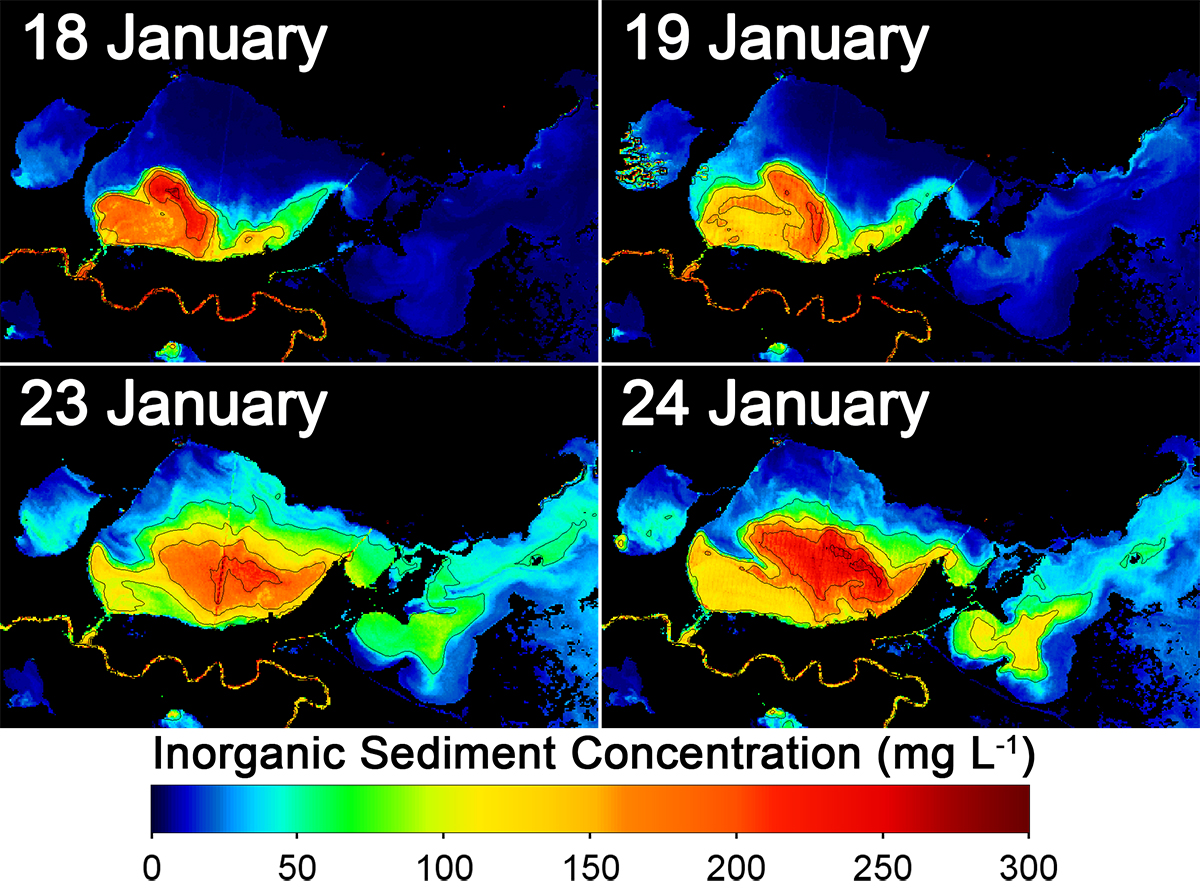
In research recently published in the journal Estuaries and Coasts, Robert Iles, a graduate student in Texas A&M University’s Department of Oceanography, and his colleagues use satellite imagery to quantify those impacts. The study concentrates on the effects of diverted water flow from the Mississippi River, through the Bonnet Carré Spillway, into Lake Pontchartrain, which is just north of New Orleans, during an opening event in early 2016.
Tracking Floodwaters
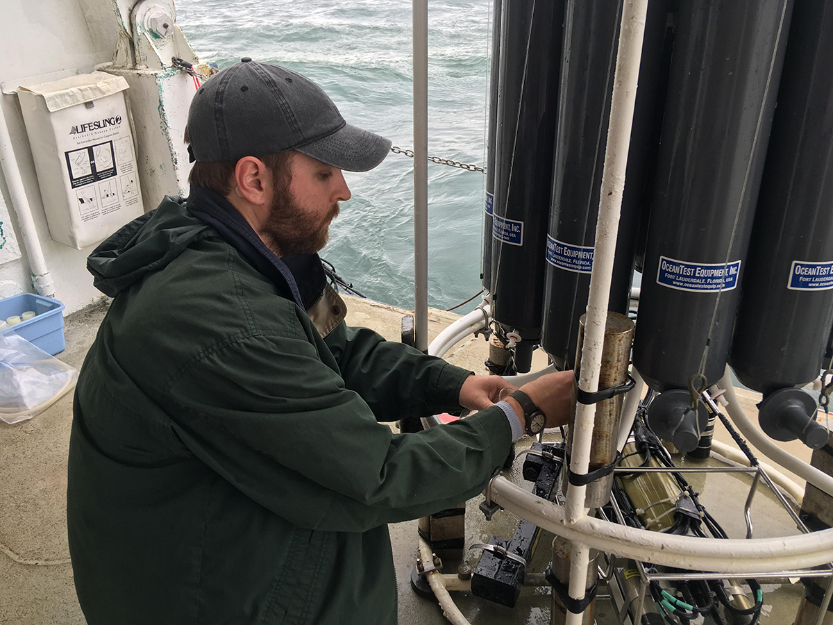
“We used 20 satellite images, collected water samples and measured the suspended sediment concentration within those samples, and then compared that to satellite reflectance,” Iles said. “We were able to come up with a predictive algorithm that estimated surface suspended sediment concentration in Lake Pontchartrain.”
By taking these measurements and images during and after the opening of the spillway, Iles and his team were able to use the suspended sediment concentration as a tracer to see where the Mississippi freshwater moved throughout Lake Pontchartrain.
Over 15% of the Mississippi River flow passed through the spillway during the event in 2016.
Overwhelming an Estuary
This large amount of freshwater influx into Lake Pontchartrain is important because Lake Pontchartrain is an estuary, where saltwater from the Gulf of Mexico mixes with freshwater.
This makes the lake a unique environment with plants and animals that are adapted to living in the brackish waters. The introduction of so much freshwater changes the salinity of the lake and can have major impacts on that wildlife.
The amount of suspended sediment can also affect how much sunlight penetrates the water, thus affecting photosynthesis by plants. The increase in nutrients from the Mississippi has also been known to produce algal blooms in the past, which can sometimes be harmful to wildlife and humans.
The researchers also included wind direction and speed with their data to see if there were any correlations with how the suspended sediment progressed through the lake. “Wind speed didn’t correspond to any increase in sediment concentration in the lake as a whole, but the wind direction did,” Iles said. “That was one of the things that was interesting to me and it underscores the fact of how variable an estuarine environment is.”
Growing up in this region of Louisiana, Iles has a personal connection to the Lake Pontchartrain area and hopes this study can add to the knowledge available to managers of these types of spillways and diversions along the Mississippi River. He would also like to see further studies examine how the additional freshwater impacts the estuary’s plant and animal life.
Read the full journal article here.
By Justin Agan ‘18