Texas A&M Professor Collected Unique Data With Mobile LIDAR During Storm Chase
Tim Logan sought out aerosol interactions with convective thunderstorms using CACE LIDAR.
Oct 28, 2019
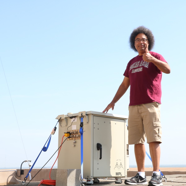
Tim Logan with the CACE LIDAR on top of the Eller O&M Building (Photo by Chris Mouchyn)
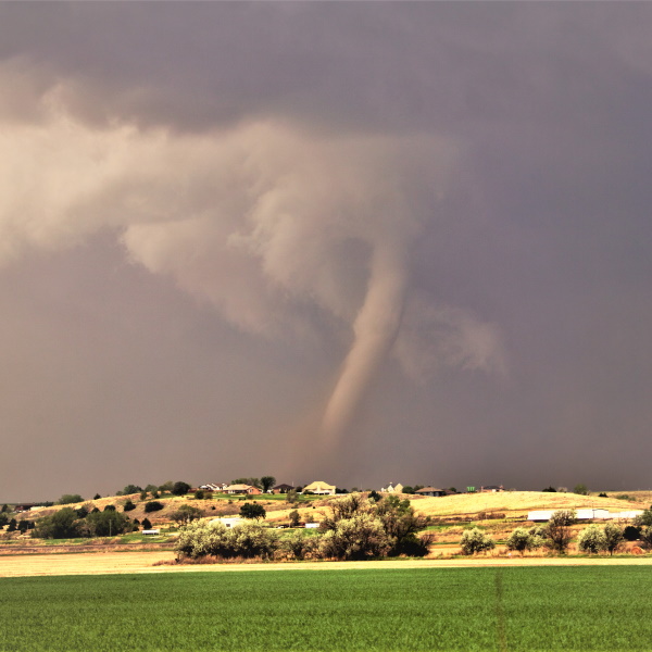
One of the tornadoes produced by the supercell near McCook, Nebraska (Photo by Tim Logan)
Dr. Tim Logan, assistant professor of Atmospheric Sciences and director of the Houston Lightning Mapping Array network, had the opportunity to take aerosol measurements during a storm chasing trip in the Southern Great Plains over the summer.
Logan used a state-of-the-art micro-pulse LIDAR, which stands for Light Detection and Ranging, to take these measurements. The LIDAR instrument is part of the Texas A&M Center for Atmospheric Chemistry and the Environment (CACE), an interdisciplinary research center that carries out research for environmental sustainability and air quality.
The storm chase began in Oklahoma shortly after the end of the Spring semester in May — an ideal time for storm chasing, because the transition between spring and summer is the climatologically most active time for severe thunderstorms in the United States. With preparation, good route planning, and a favorable environment, seeing supercell development would be likely. Logan said that this presented a good opportunity to have multiple vantage points to transect a developing supercell.
The LIDAR has mobile capability, which allows for the observation of thunderstorms from a variety of vantage points.
Since July 2018, the LIDAR has been running on the rooftop of the Eller O&M Building, and has been gathering a variety of data, but opportunities for transecting passing thunderstorms are limited.
“There have been a couple of times where thunderstorms have passed directly over the O&M Building with the LIDAR running,” Logan said. “And, you can get certain vantages of the anvil, stratiform rain, and convective core regions. But you have to be lucky enough that the storm will pass directly overhead.”
Logan believes that, while the National Weather Service and other organizations were also out with monitoring equipment to take observations that day in May, he was the only one with a LIDAR. DOWs, or Doppler On Wheels, are mobile radar units that are often taken to observe supercells in developing environments, but LIDARs are not frequently used for this kind of field observation, so Logan’s data is unique. LIDAR operate on the same physical principles as radar, but can take different sets of observations, and so having a LIDAR present allows for a fuller suite of observational data.
And that afternoon, Logan was able to collect some fascinating data.
“We intercepted a TVS (tornadic vortex signature) — the TVS passed right over the beam,” Logan said. “We were able to successfully intercept a tornadic supercell: the wall cloud, the TVS, anvil region, stratiform rain region, everything. I’m pretty sure what was I was looking at went on to make the McCook tornado in Nebraska, so we were right there when it was just forming.”
That supercell would go on to produce 2-3 inch diameter hail and four tornadoes, including one that was rated as an EF-2, with wind speeds of 120 mph.
For now, the LIDAR is back on the roof of the O&M Building, taking steady measurements of the atmospheric column as various particulates flow overhead, from aerosols to Saharan dust and more. Since beginning operation in 2018, it has been continually delivering interesting data, and, since it survived a passing tornadic thunderstorm, will continue to do so.
By David Coates
