Texas A&M GERG Data Fuels Storm Prediction Efforts In The Gulf
The TABS off-shore system of buoys run by GERG and funded by the Texas General Land Office provides life-saving data during hurricane season.
Jul 11, 2019
With the season’s first tropical storm brewing just off the coast, an off-shore system of buoys run by Texas A&M University scientists and funded by the Texas General Land Office is working to help predict its path and intensity.
“Texas and other Gulf Coast states know all too well that Hurricane season is no joke,” Texas A&M University System Chancellor John Sharp said. “Thankfully, scientists from Texas A&M are working to get information to the public about storms as they develop and threaten Gulf Coast states.”
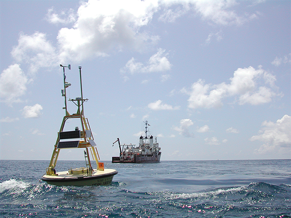
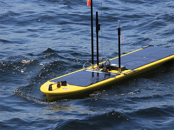
Where the potential Tropical Storm Barry lands, or if it even becomes a tropical storm at all, is being determined with data provided by the Texas Automated Buoy System (TABS).
TABS is a real-time oceanographic buoy system that measures winds, waves, currents, salinity and other parameters. It is one of the oldest and most successful state funded, ocean-observing systems in the country.
The data-collecting devices constantly record water temperature, currents, wind speed and other measurements. And now that Hurricane season is here, researchers with Texas A&M University’s Geochemical Environmental Research Group (GERG), part of the College of Geosciences, are working to provide vital information about the storms that will enter the Gulf of Mexico and threaten Texas and other states.
Anthony Knap, director of the GERG and a professor of oceanography at Texas A&M, said the group’s mission is to provide information to the public and public entities such as the National Hurricane Center. Specifically, the data being collected by Knap and his team can help predict how powerful a storm can become.
In addition to the TABS buoy system, Knap and his team at GERG are also working to secure funding to deploy other devices, such as oceangoing gliders that can fly through the water and an unmanned, wave-powered surface vessel to study the Gulf. The more data GERG can collect, the better their predictions will be in the future, he said.
“These tools will give us more opportunities to get continuous data,” Knap said.
Another major project of the GERG involves using a system of high-frequency radars in cooperation with TABS. Knap said the units can collect detailed, real-time data on weather, water currents and ecosystems. The data helps scientists predict how oil spills will disperse; plus the information can help with search and rescue operations when someone is lost at sea.
The project is partially funded by the Texas A&M University System’s Chancellor’s Research Initiative and is in collaboration with TGLO, NOAA, NASA, the Gulf of Mexico Coastal Ocean Observing System, the Ocean Observing Initiative and other international partners, such as Mexico, Brazil and Cuba.
The system is the most comprehensive of its kind, but Knap and his group still hope to expand it and connect it with existing networks along the East Coast and into international waters.
“The Gulf region is among the most important to the interests of the United States and Texas, with many economic, public safety and geopolitical implications,” Sharp added. “Texas A&M has the obligation and the responsibility to provide the expertise, leadership and solutions to real-world challenges that affect Texans and other people around the world.”
Watch a video of Chancellor Sharp exploring GERG with GERG Director Anthony Knap.
