Aggies And Geospatial Tech Helped Brenham Turn Dead End Into Historic Site
Camptown Cemetery is the oldest predominantly African American cemetery in Brenham, and Texas A&M Geosciences students helped identify the locations of its unmarked graves.
Feb 28, 2018
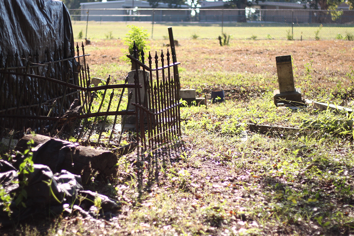
In May of 2013, the Camptown Cemetery in Brenham, Texas, was nothing but a dead-end road sign on a piece of neglected land. A year later an official Texas Historical Commission (THC) Plaque finally was placed where that sign had been.
The Brenham Heritage Museum led the restoration of the cemetery, which began with removing decades of brush and decay. Several local biker groups, a Buffalo Soldiers organization, and numerous community members and groups also volunteered to help clear and restore the land, uncovering more and more forgotten gravestones.
But there was one problem they needed technical assistance with: unmarked graves. In mid-2013, a museum staff member reached out to the Texas A&M University Department of Geology and Geophysics, because the museum wanted to know the location and extent of the cement burials. The department knew how to help.
The History of Camptown Cemetery
Officially established in 1868, Camptown Cemetery is the oldest predominantly African American cemetery in Brenham. However, it is believed that burials date back as far as the 1830s. It is historically associated with Mt. Rose Missionary Baptist Church.
“Camptown Cemetery remains hallowed ground and a precious record of the early history of the community,” reads the THC marker.
At least 40 former slaves are known to be buried there, according to the church.
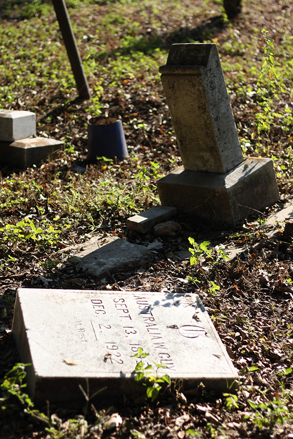
Other people laid to rest there include Texas Revolution soldiers, soldiers who were victims of yellow fever outbreaks of 1866-67, and veterans who served in wars. A total of 81 headstones dot the land, but the community restoration team estimates that around 196 people are buried there. Along with unmarked bodies, many of the headstones had been moved and no longer sat in the correct locations.
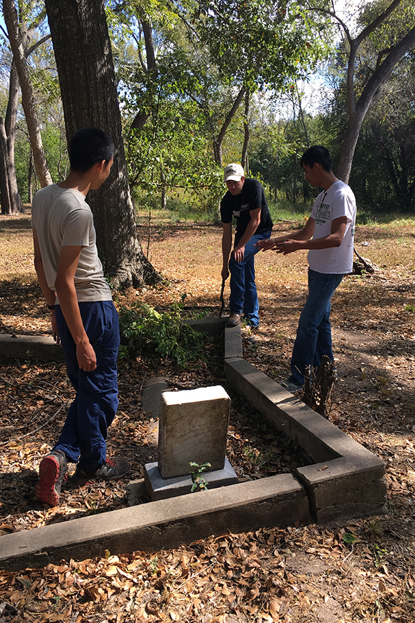
Aggie Undergrads Used Technology To Help
Then undergraduate student Tate Meehan, under the advising of geology and geophysics professor Dr. Mark Everett, used a noninvasive geophysical survey to detect soil disturbances or magnetic bodies within the subsurface to help identify potential sites of unmarked graves.
This successfully showed concrete structures below the surface but did not identify bodies that were not in concrete. Because of the clay rich soils and subtropical climate in this region of Texas, bodies not in caskets were nearly impossible to identify.
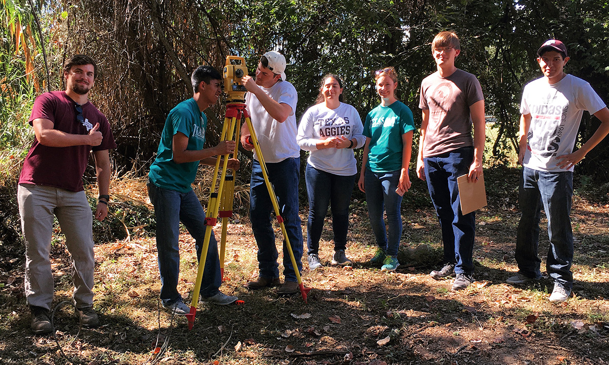
After Meehan graduated, the Texas A&M University Geography Society continued his work, this time to identify bodies below the surface that were not in concrete. To do that, they used a total station, a traditional surveying technique that includes a laser mounted on a tripod and a reflecting prism. To locate the sites of unmarked graves the team identified a 17-meter tract that seemed to have grave-sized depressions in the dirt and then used GPR to analyze the area, the students said.
The information was then processed into an image that showed soil disturbances that could possibly be unmarked graves, but disintegration made it impossible for the GPR to completely confirm the graves.
Service Learning Always A Priority For Aggies
Projects like this are important for many reasons, Everett said.
“It’s a real-world problem, and it’s outreach to the community. It’s about cultural history; it is about connecting a community to its past,” he said. “There’s so many different levels; it is about human dignity, burial, reversing neglecting and maintaining the past, all of those things.”
Being in the field to do hands-on work was beneficial for the students, as well as the community. Students “learned about the challenges that you have when you’re doing a project that is not necessarily a textbook project,” Everett said.
Partnering with the community for projects like this one is extremely important, because “it’s about showing them that we’re not in ivory towers sitting in our offices solving big mathematical equations or developing enormously complicated theories about things,” Everett said. “We want to be useful, we want to do practical things, and we want our students to get experience not only with the equipment and that but also working on real problems with real people.”
The Research Continues
This service research project has continued, and in the 2017 GIS Day poster contest, now-graduate student Hailey Duncan, senior GIS student Daniel Huseman, and now former students Jacqueline Clay and Laura Everett submitted a research poster about how the ground penetrating radar data was collected and processed for the cemetery project, and what that analysis showed.
“We chose this project because it was an opportunity to increase and apply the skills we were learning in lecture to a real-world situation,” Duncan said, “more importantly this project had a lot of love and dedication behind it.”
The Brenham community is continuing the work of preserving the cemetery and all the stories of the past that it holds. You can learn more about Camptown Cemetery and the lives memorialized there at:
- The Texas Historical Commission
- The Camptown Cemetery Blog
- Rose Missionary Baptist Church
- Rose Missionary Baptist Church Camptown Cemetery Photo Gallery
By Taylor Fuechec
