Texas A&M Scientists Develop Crucial, Multiscale Oil Spill Model
Supported by the BP-funded Gulf of Mexico Research Initiative, new computer model covers scales from droplets to oceans, to predict how future oil spills would travel in the Gulf.
Jun 13, 2019
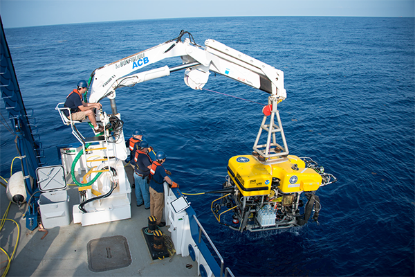
Scientists recover remotely operated vehicle ROV Hercules at the Green’s Canyon underwater oil seep. (Photo by Susan Poulton.)
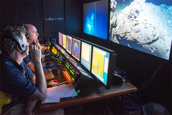
Scott Sofolofsky (background) and GISR PI Chip Breier (foreground) work in the ROV control room on the E/V Nautilus.
The Deepwater Horizon oil spill on April 20, 2010, was the largest marine oil spill in United States history. The first deep subsurface spill, it pumped about 700,000 tons of crude oil, plus about 250,000 tons of methane, into the Gulf of Mexico before it was capped, and tragically led to 11 deaths and 16 injuries to people on the rig.
During the spill, available oil spill computer models operated at different scales, but did not interact, and they also did not include many of the shallow bays along the northern Gulf that are of great importance to local fisheries. This spill created a need for an integrated, multiscale, comprehensive computer model suite that showed the behavior of the petroleum fluids on a 3D scale rather than a 2D and operated from the molecular level to the scale of the Gulf.
Texas A&M University scientists have now created such a model suite.
A description of the model suite was published in a recent paper by Dr. Piers Chapman, research professor in the Texas A&M Department of Oceanography; Dr. Steve DiMarco, oceanography professor and team leader for ocean observing in the Geochemical and Environmental Research Group (GERG) at Texas A&M; Dr. Robert Hetland, oceanography professor; and Dr. Scott Socolofsky, professor in the Zachry Department of Civil Engineering.
Their integrated, multiscale set of models can help explain ocean dynamics and assist in making predictions for future oil spills, Chapman said.
The Gulf of Mexico Research Initiative (GoMRI) was set up with funding provided by BP to improve the science for responding to future spills. Under GoMRI, the Gulf Integrated Spill Research (GISR) consortium was established to increase the understanding of how petroleum fluids in the ocean behave and improve the ability to predict what happens after a spill. This research was funded by GoMRI.
At the most basic level, the model suite used information about the natural rates of mixing, dissolution, evaporation, and degradation once oil and gas are released into the environment. The group used data from field and laboratory experiments to test how well the different physical models of oil movement operated. The scales used were graduated, “the largest scale was a model of the whole Atlantic, and then the Gulf of Mexico on the next scale down, then a shelf model of the coast, and then a bay model being the final bit,” Chapman said.
With today’s large amount of offshore drilling, it is important to understand the changes in coastal currents to be able to forecast where the oil in a potential spill would go, Chapman said.
“It’s a forecasting methodology to show how the oil, any future oil spill, will likely impact the coast,” he said.
Cruises Provided Field Data And Student Experiences
While developing the model, consortium members conducted field experiments to study how the oil would travel within the water column, and how it spread from the source of the spill. These included direct observations of natural underwater oil seeps using an autonomous underwater vehicle (AUV), as well as mimicking a spill at depth to see how a real subsurface spill might behave.
The team conducted nine cruises, ranging from a week to a month in length. It was an opportunity for many students to get experience, with 13 doctoral, 14 master’s and nine undergraduate students sailing on one or more cruises. Many of these students “were able to use these seagoing days to also get data for their own dissertations and theses,” Chapman said.
On one research cruise, the scientists were using the AUV to observe and take pictures of natural oil seeps, when a young sperm whale decided to check things out. Dr. Chapman described this as “probably the most exciting thing that happened during (the) field work,” and it was a unique experience for the scientists who captured the whole encounter on video.
This research impacts the local ecology and economics of communities along the coast, Chapman said, because “if we can forecast where this oil’s going to go, it means that you can get the citizens who are likely affected in the know as soon as possible. You can determine where best to apply cleanup efforts, and where they’re most likely to be needed.”
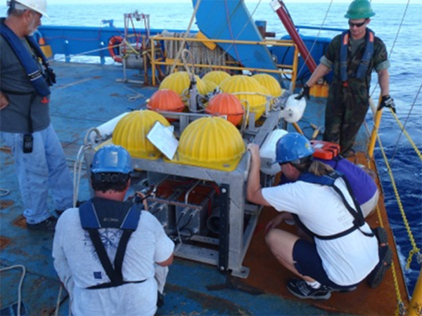
Students assist in preparing equipment for sampling on the R/V Brooks McCall, during an experiment mimicking a deep spill.
Monitoring The Gulf 24/7
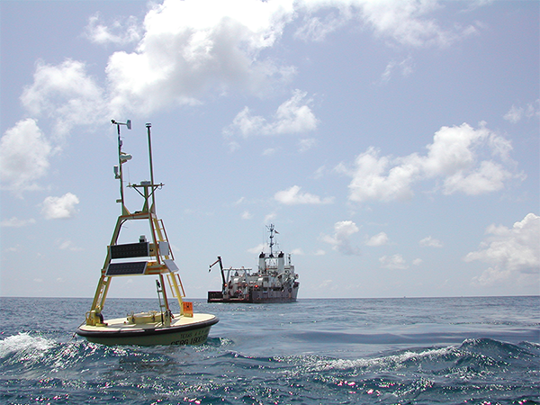
Texas A&M GERG, part of the College of Geosciences, has a series of moorings and buoys along the Texas coast that has been operational for 20 years and provides crucial data to agencies and communities in Texas. This technology helps largely in “providing information on winds, waves, and currents that can be used specifically for oil spill tracking,” Chapman said. These moorings and buoys help scientists and everyday citizens track where water is flowing from and where it is expected to go.
Data collected from GERG-operated moorings and buoys contributed to the new model.
From this research we now “know a lot more about the circulation in the Gulf of Mexico and the ecology of the Gulf than we did beforehand,” Chapman said. And, since “they’re circulation models, they are improving our knowledge of how the Gulf works, physically and chemically.”
By Amanda Hoth ’21
